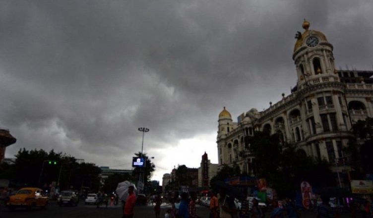
Kolkata, March 26 — A spell of thunderstorms and rainfall is expected to sweep across several parts of West Bengal over the next few days, according to the India Meteorological Department (IMD). The forecast comes amid a steady rise in temperatures and increasing humidity levels that have made weather conditions uncomfortable, particularly in the southern districts and the state capital, Kolkata.
The expected weather activity, driven by pre-monsoon conditions, is likely to bring temporary relief from the prevailing heat. However, authorities have also cautioned residents about potential hazards such as strong winds, lightning, and localized disruptions.
Key Announcements and Highlights
The IMD has indicated that weather conditions will remain unstable through the end of the week, with multiple districts likely to experience varying intensities of rainfall and thunderstorm activity.
Five districts in south Bengal are expected to witness Kalbaisakhi storms on Friday. These storms, also known as nor’westers, are characteristic of eastern India during the pre-monsoon period and are often accompanied by sudden changes in weather, including sharp gusts of wind, lightning strikes, and short but intense rainfall.
Wind speeds during these events could reach between 50 and 60 kilometres per hour in certain areas, posing risks such as tree falls, power outages, and minor infrastructure damage. In Kolkata and adjoining regions, wind speeds are expected to remain slightly lower but still significant, ranging between 40 and 50 kilometres per hour.
Rainfall activity is also likely to continue into Saturday, particularly in districts such as Purulia, Bankura, Jhargram, Paschim Medinipur, and Paschim Bardhaman. Meanwhile, north Bengal districts are expected to experience more widespread rainfall during this period.
Official Statement (Rewritten)
Officials from the IMD have noted that the ongoing weather pattern is consistent with seasonal changes typically observed during late March. They highlighted that the combination of rising temperatures and moisture incursion from nearby regions has created favourable conditions for thunderstorm development.
The department further stated that while intermittent rainfall over the past few days has already provided brief relief, the upcoming spells are expected to be more widespread and impactful. At the same time, residents have been advised to remain cautious, particularly during peak thunderstorm hours, due to the risks associated with lightning and strong winds.
Understanding Kalbaisakhi Storms
Kalbaisakhi storms are a defining feature of the pre-monsoon season in eastern India, particularly in states like West Bengal, Odisha, Assam, and parts of Bihar. These storms usually occur between March and May and are known for their sudden onset and high intensity.
They are formed due to the rapid heating of land during the day, which creates instability in the atmosphere. When this warm air rises and interacts with cooler air at higher altitudes, it leads to the formation of cumulonimbus clouds, resulting in thunderstorms.
While these storms can cause temporary disruptions, they also play an important role in regulating temperature and providing moisture ahead of the monsoon season. For farmers, in particular, pre-monsoon rainfall can be beneficial for certain crops, although strong winds and hail can sometimes lead to damage.
Context: Rising Temperatures and Seasonal Transition
West Bengal has been experiencing a gradual increase in temperatures since February, with both day and night temperatures trending above normal levels. The rise in humidity has further intensified the discomfort, especially during the early morning and late afternoon hours.
Kolkata, along with several districts in south Bengal, has reported sultry conditions in recent weeks. The combination of heat and moisture has created an environment conducive to thunderstorm formation, which is now beginning to manifest more frequently.
Meteorologists note that such weather patterns are typical during this time of the year, as the region transitions from winter to summer. The increasing frequency of thunderstorms is often seen as a precursor to the arrival of the southwest monsoon, although that is still a few months away.
District-Level Impact and Forecast Details
The IMD’s forecast outlines varying weather conditions across different parts of the state.
In south Bengal, districts such as Purulia, Bankura, Jhargram, Paschim Medinipur, and Paschim Bardhaman are expected to see the most significant impact from thunderstorm activity. These areas may experience heavy rainfall, gusty winds, and lightning, particularly on Friday and Saturday.
Kolkata and its surrounding areas are also likely to witness thunderstorm activity, although the intensity may be slightly lower compared to the western districts. Even so, gusty winds and moderate rainfall could lead to localized waterlogging and traffic disruptions in the city.
In north Bengal, rainfall is expected to be more widespread, covering multiple districts. While the intensity may vary, the overall pattern suggests a sustained period of wet weather across the region.
Public Impact: What This Means for Residents
For residents, the upcoming weather changes bring both relief and caution.
On the positive side, the rainfall is expected to lower temperatures and provide respite from the ongoing heat and humidity. This could improve overall comfort levels, particularly in urban areas where heat retention tends to be higher.
However, thunderstorms also come with certain risks. Strong winds can uproot trees, damage temporary structures, and disrupt power supply. Lightning poses a serious safety hazard, especially for people working outdoors.
Commuters may face delays due to waterlogging or reduced visibility during heavy rainfall. In rural areas, farmers will need to monitor conditions closely, as while rain can benefit crops, strong winds or hail may cause damage.
Authorities have advised people to stay indoors during thunderstorms, avoid sheltering under trees, and take necessary precautions to ensure safety.
Safety Advisory and Precautionary Measures
The IMD has urged residents to remain vigilant during this period of unstable weather. Basic precautions can significantly reduce the risk of accidents and injuries.
People are advised to avoid open fields and elevated areas during lightning activity. Electrical appliances should be unplugged during severe storms to prevent damage from power surges. Those living in areas prone to waterlogging should take necessary steps to safeguard their homes and belongings.
Motorists are encouraged to drive cautiously during heavy rain and strong winds, while pedestrians should be mindful of falling debris or loose structures.
The current spell of thunderstorms and rainfall is expected to continue through Saturday, with conditions gradually improving from Sunday afternoon onwards. As the weather stabilizes, temperatures may begin to rise again, although the immediate relief from heat is likely to be noticeable.
Meteorologists will continue to monitor developments, particularly as pre-monsoon activity intensifies in the coming weeks. For now, the forecast signals a typical seasonal shift, bringing both cooling rains and the need for caution.
For residents across West Bengal, the coming days will serve as a reminder of the region’s dynamic weather patterns—offering a break from the heat, while also underscoring the importance of preparedness during storm activity.
Inputs and images : Hindusthan Samachar
Edited By E. Devanshi varma
Also Read: Akshardham Unveils 108-Foot Neelkanth Varni Statue, Marking Major Spiritual Milestone in Delhi
Follow us on Google News: Click Here
Last Updated on: Thursday, March 26, 2026 2:45 pm by E. Devanshi Varma | Published by: E. Devanshi Varma on Thursday, March 26, 2026 2:45 pm | News Categories: India